Kuala Kangsar (Kuala Kangsar)
 |
The site must have had a strange effect on Sultan Yusuf Sharifuddin Mudzaffar Shah of Perak who ruled from 1877 to 1887. Unlike many rulers who protected their royal palaces and strongholds by selecting their vantage points carefully where they could detect enemy approach from afar, the Sultan had his first royal palace built beside the riverbank. He then named it 'Istana Sri Sayong'.
Apart from being exposed to the impending threat of invasion, the other problem was the force of monsoon seasons, which led to numerous flooding as water gushed down from the jungles above through the many tributaries. The name Kuala Kangsar is believed to be derived from 'Kuala Kurang-Sa', which literally means '100 minus (-) one', usually interpreted as 'the 99th small tributary to flow into the Perak River'.
One flooding was so severe, it almost swept the palace away. Finally, after the Big Flood or Air Bah in 1926, it was decided to move the place further up onto the knoll where stands the current Royal Palace named Istana Iskandariah with its Art-Deco architecture, a rare but significant piece of architectural milestone in Malaysia.
The Sultan of Perak officially resides in Kuala Kangsar, and it has been Perak's royal seat since the 18th century. It is one of four towns that plays a role in Perak's complex succession system. It was the administrative seat of the first British Resident in the Malay Peninsula, James W. W. Birch, from October 1874 until he was murdered on 2 November 1875. It was the capital of Perak until 1876.
Kuala Kangsar is also known in Malaysian history as the site where the first Conference of Rulers of the Federated Malay States, the Durbar, was held in 1897. By the 1890s, the growth of the tin mining towns of Ipoh and Taiping had eclipsed Kuala Kangsar, but it remains to this day one of the most attractive of the Malay royal capitals.
The town is also the site of the first rubber tree planted in Malaysia. The person responsible was the English botanist Henry Nicholas Ridley. He was the one who helped Malaya and eventually Malaysia become the largest rubber producer in the world. The tree still stands today.
The first Malaysian scout troop was established in Kuala Kangsar. Consequently, its squad number is 001.
Map - Kuala Kangsar (Kuala Kangsar)
Map
Country - Malaysia
 |
 |
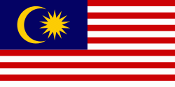
| Flag of Malaysia | |
Malaysia has its origins in the Malay kingdoms, which, from the 18th century on, became subject to the British Empire, along with the British Straits Settlements protectorate. Peninsular Malaysia was unified as the Malayan Union in 1946. Malaya was restructured as the Federation of Malaya in 1948 and achieved independence on 31 August 1957. The independent Malaya united with the then British crown colonies of North Borneo, Sarawak, and Singapore on 16 September 1963 to become Malaysia. In August 1965, Singapore was expelled from the federation and became a separate independent country.
Currency / Language
| ISO | Currency | Symbol | Significant figures |
|---|---|---|---|
| MYR | Malaysian ringgit | RM | 2 |
| ISO | Language |
|---|---|
| ZH | Chinese language |
| EN | English language |
| MS | Malay language |
| ML | Malayalam language |
| PA | Panjabi language |
| TA | Tamil language |
| TE | Telugu language |
| TH | Thai language |


